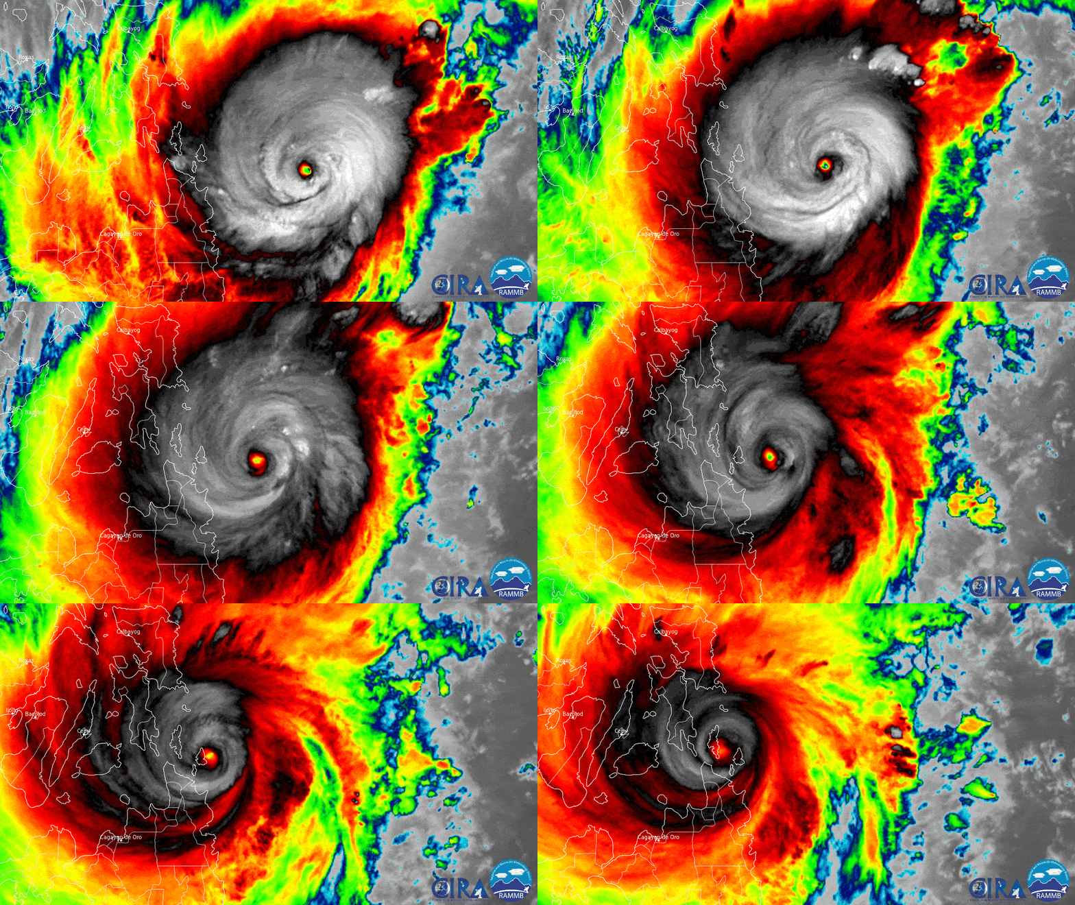
The Himawari-8 satellite, operated by our partners at the Japan Meteorological Agency, has been closely monitoring Typhoon Rai, known in the Philippines as Typhoon Odette. The above infrared imagery, showing the cold cloud tops, was captured as the then-Super Typhoon (winds greater than 150 mph ) made landfall on Siargao Island in the Philippines around 1:30 p.m. local time on Thursday, Dec. 16.
The day before landfall, the storm rapidly intensified from the equivalent of a Category-1 Atlantic hurricane on the Saffir-Simpson Hurricane Wind Scale to a super typhoon, equivalent to a Category-5 hurricane, with maximum sustained winds of 160 mph. Rapid intensification occurs when a tropical cyclone strengthens at least 30 kts (about 35 mph) in a 24-hour period.
Rai is the fourth Category-5 equivalent typhoon of the season in the West Pacific, and the 15th this year to pass through or close to the Philippines. Since making landfall, it has pushed across the island nation and into the South China Sea, where it remained a strong Typhoon Friday evening, local time.
This image was captured by the Advanced Himawari Imager (AHI) on Japan’s Himawari-8 satellite. This satellite, the first unit of the Japan Meteorological Agency's (JMA) third-generation of geostationary satellites, provides visible light and infrared images of the Asia-Pacific region. Himawari's data are vital for global geostationary coverage, which is why NOAA and JMA have agreed to mutual back-up arrangements for their geostationary systems.